Home services · 2024
FIX - Home Services App
A modern platform connecting customers with professional tradespeople — a mobile app, web portal and AI-powered search.
React NativeExpoNext.js
A social GPS platform for off-road enthusiasts — route recording, real-time tracking of group trips and offline maps.

Offroad Buddies wanted to bring off-road enthusiasts in Bulgaria together through a mobile app for route sharing, organizing group trips and real-time communication in the field.
We developed a React Native app with MapBox integration for GPS tracking, social features for sharing routes and photos, group chat and an event organization system.
Everything an off-road enthusiast needs — GPS, maps and community.
Record every off-road adventure with high accuracy. Routes are saved with elevation data, speed and photos taken along the way.
See your friends on the map in real time during group outings. A WebSocket connection provides instant updates.
Download maps for offline use before your trip. No internet is needed in the mountains — MapBox provides full functionality.
Offroad Buddies is more than a GPS tracker — it’s a social network for the off-road community. Follow friends, compete in leaderboards and earn badges.
MapBox provides offline maps with terrain and satellite imagery. PostGIS on the backend processes geospatial queries — nearby routes, intersection points and regional statistics. WebSocket connects everything in real time.
MapBox GL · PostGIS · WebSocket · React Native Maps · Turf.js · GeoJSON
Offroad Buddies is a mobile app for the off-road community that allows users to record routes, share them with friends and track each other’s location in real time during group trips.
The key feature is real-time tracking during group trips — each participant can see the others’ positions on the map, which is essential in off-road terrain where mobile coverage is unreliable. The app pre-caches maps for offline use.
The MapBox SDK provides detailed topographic maps with information about terrain, gradient and elevation. Users can mark points of interest — water crossings, steep sections and camping spots.
Social features include profiles, followers, route sharing and leaderboards for the “longest route”, “highest point” and similar achievements. This encourages engagement and regular use.
The backend is built with .NET, PostgreSQL and PostGIS for geospatial queries. Real-time tracking uses WebSocket for minimal latency.
A modern platform connecting customers with professional tradespeople — a mobile app, web portal and AI-powered search.
A mobile app that watches through the phone’s camera, counts reps and corrects your form by voice, in real time, without the video ever leaving the device. App, backend, admin panel and website built from scratch.
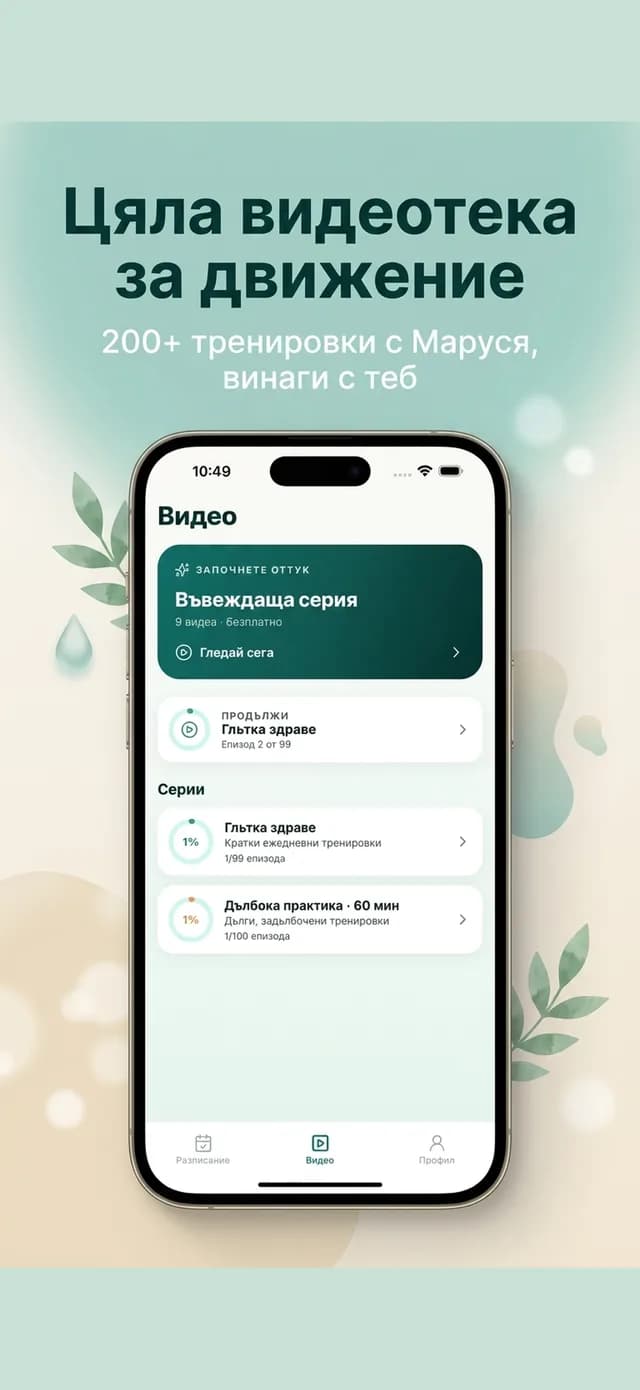
iOS app for therapeutic and rehabilitative exercise — video workouts in Bulgarian, progress series and registration for live classes.
We only use analytics and advertising cookies if you accept them. The site works without them too. Details ·